PAG 2: Roman Road visit to Downham and Rimington Date: 01 April 2021
We visited the section of concessionary footpath from Town End Croft Wood (NGr. 378534 444507) to Hall Royds Wood (NGr. 378843 444591) to see if there were any observable features which could be considered to be ‘Roman’. We were concerned that the agger-like features running roughly WSW-ENE between the woods had more to do with the underlying limestone geology. The nearby quarry exposes Chatburn Limestone strata dipping at 45 degrees to the SE. Surface quarrying or glacial erosion of the strata could have produced the observable upstanding linear features.
There is an interesting terrace to the north of the ridge line about 5m wide and bounded to the north by a small bank which could be interpreted as a ditch-like feature. The field to the north showed ‘ridge and furrow’ running perpendicular to the bank. The terrace is very flat and bounded to the south by a Limestone embankment which could be interpreted as either quarried or the results of natural erosional processes. However, this feature disappearswhere the line of an old wall or hedge-line crosses it at 90 degrees (NGr. 378758 444644).
It is very clear that the bedrock is very close to the surface and is exposed as the footpath passes the south west corner of Hall Royds Wood (NGr. 378843 444591).
The wood was not entered, but the path was followed to the east end of Hall Royds Wood. Along the same alignment, from there to the field gateway at NGr. 379129 444611, runs a distinctive feature that is often described and photographed as an agger. This feature was not measured, but appeared too narrow to be the actual surface remains of a Roman Road also was distinctly curved and looked more like a field boundary.
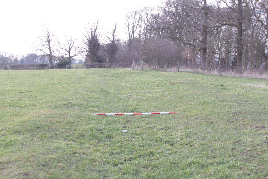
Supposed Roman agger running ENE from Halls Royd Wood, Downham
In conclusion, we believe that the Roman Road passed close to this point in Downham, but we were not convinced that we had seen any features, which proved that this was the actual course of the Roman Road.
We relocated to look at the road to the north and East of Hollins Farm, Rimington (NGr. 381321 445181) courtesy of the farmer. We had difficulty identifying the line of the road on the ground from Windhill Laithe at NGr. 381140 445390 to the stream at NGr. 381649 445609, but we did observe an anomalous group of flat stones in the stream bed. We looked at the southern end of Windy Hill Lane. This substantial “green lane” bounded on each side by banks and ditches and with a roadway some 5m wide is a puzzle. It is wide enough to allow two wagons to pass, but after reaching Windhill Laithe, it takes a turn to the WSW and abruptly ends as a track giving access to a field overlooking Ings Beck.
Peter made a good observation that the proposed line of the road west of Ings beck is not aligned with any current or known past field boundaries in stark contrast to the line of the road east of Chatburn. East of Howgill (NGr. 382504 445997), the projected line once more starts to align with current and past field boundaries.
In itself, the day did not provide conclusive evidence that the accepted line of the road is wrong, but our lack of findings gave us much cause for thought.
Barrie Tyrer, Brian Jeffery and Peter del Strother