Organised by the Friends of Pendle Heritage (Pendle Archaeology Group)
The aim was to follow the suggested RR from west of Martin Top Chapel to the A682. The objectives were to identify a number of locations where future investigations and possible excavations may take place. Elizabeth Robinson, the farmer’s wife, shared her knowledge of Rakes Farm footpaths, tracks and drainage, while Trevor Marklew pointed out interesting places and items of the heritage of Gazegill and Howgill eg. Gazegill Green (now Beckside Farm), Howgill cotton mill, Howgill corn mill, Howgill manor house, Howgill Barn and the old smithy. GPS data recordings were made by Brian Stott and Peter del Strother.
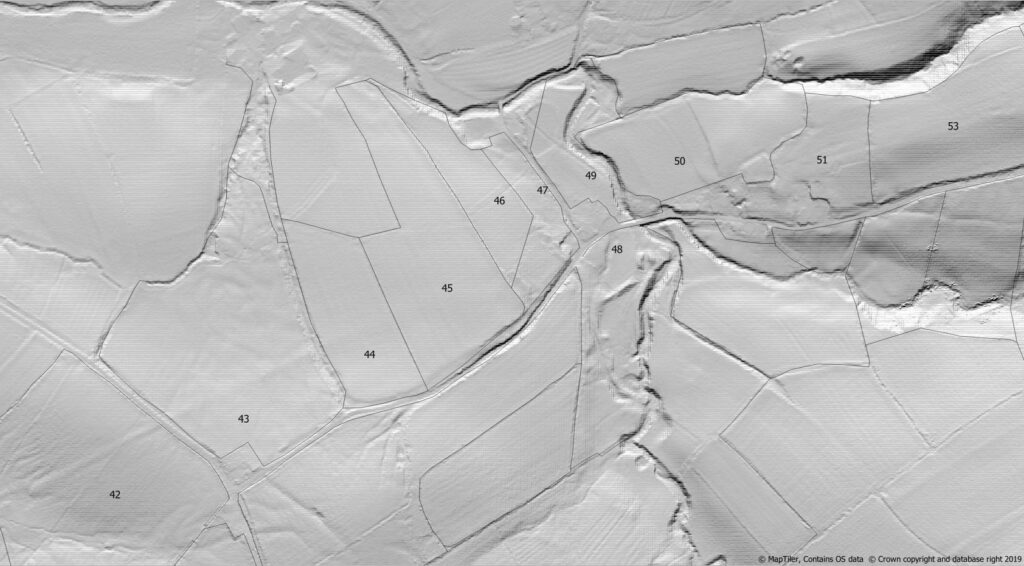
Elizabeth Robinson supplied information on Fields south of Rakes Barn the farm access was previously from a gate on Newby Lane at NGr 381972 445824.’ On the 1849 OS map, Rakes Farm had an access road called Rakes Lane and this survived until at least 1910. ‘The present farm track was laid over a public footpath in 1953. The field has been ploughed frequently to a maximum of 5-6”, so as not to bring sub-soil to the surface. During ploughing, large stones had been unearthed along a distinct ENE-WSW terrace across the whole field.’ At the eastern end, a GPS reading on the ‘terrace’ was taken at NGr 382175 445869.
‘The hedge between Fields 44-45 dates from WWII and POWs filled in a pond in Field 44 at NGr 382226 445807.’ Beyond this point, the RR terrace became indistinct and the following notes should be treated with caution, as our RR route is purely conjectural. Across Field 43, the RR route seems to follow a magnetic bearing of 66 degrees. By the hedge in field 44, there was some stone at all the three following locations, but the amount and depth of stone was not definitive. GPS readings were taken at NGr’s a) 382268 445931, b) 382276 445913 and c) 382281 445894. From the original bearing in Field 43, these locations cover a reasonable spread of angles and they are recorded on the accompanying Lidar map.
At the eastern end of Field 45, the RR route was not visible on the ground. The slope down to Howgill Beck was considered to be a problem, especially as the nearby Long Lover Lane was on a 14-20% gradient (1 in 5 to 1 in 7). It has been cut down through the till into solid rock, exposing the Worston Shales Group dipping at 65 degrees to the N. Further exposures of posts of limestone were seen in Howgill Beck between Howgill Old Cotton Mill and Beckside Farm, suggesting that the rockhead is not far below the surface and the till is only a few metres thick. The projected route from Field 45 to Howgill Lane would put the RR route under Howgill Barn, Howgill Manor House and other nearby houses.
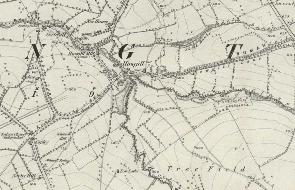
The suggested line of the RR along Howgill Lane was followed as far as the A682. Alongside Fields 53-54, the RR route is assumed to lie under Howgill Lane, but, as it approaches the A682, the present lane appears to deviate away from that suggested for the RR route on the 1849 OS Yorks Sheet 183 map. In Field 55, there is a distinct ditch on a NE-SW line, which ended at the A682. From this viewpoint, there was no obvious continuation of this potential RR route line across the A682 into Field 56.
Returning along the lane to Martin Top Chapel, we looked at Field 42. This appears to have a distinct ‘agger-like’ structure following the same magnetic bearing of 66 degrees. This bearing aligns the summit of the hill at NGr.381944 445756 with the side of Newby Lane at NGr.381999 445784 and the original location in Field 43 at NGr.382175 445869.