The Roman Road on early Ordnance Survey Maps.
Below is a detail from a 1844 six inch OS map. The line of the road is clearly shown. In many places the road is show as an earthwork in places where no earthwork can be seen today.
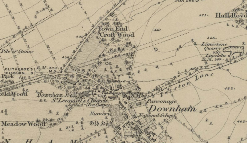
You can download a set of higher resolution images (3000 x 2000 approx. at 300 pixels per inch) of the 1844 Lancs. and 1849 Yorks. OS six inch maps covering the project length.
OS maps Crown copyright Ordnance survey maps are reproduced with the permission of the National Library of Scotland.
Click Here To download OS Six-inch 1844 1849 RR project ZIP File 16.2 mb.
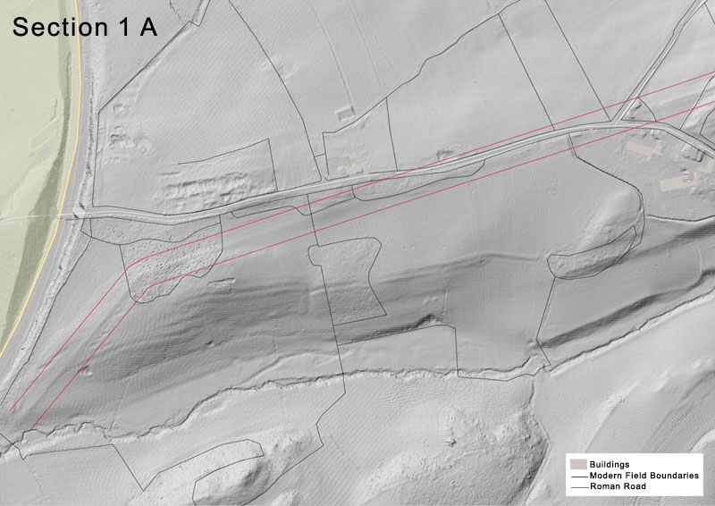
Roman Road revealed by Lidar.
Below is the western half of Section one with the A59 on the left edge and Downham Hall on the right edge. The Roman road in this image can be seen as an earthwork between the red lines which indicate the probable course of the road. Black lines are modern field boundaries.
To view more visit the Lidar Page
You can download higher resolution Lidar images (1500 x 800 approx. at 300 pixels per inch) of the project length.
Click Here To Download Roman Road Lidar ZIP File 8.7 mb.
Text and lidar images by Barrie Tyrer