Aims
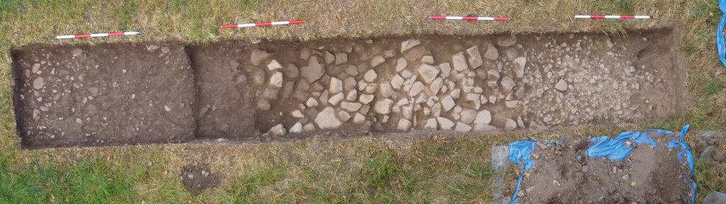
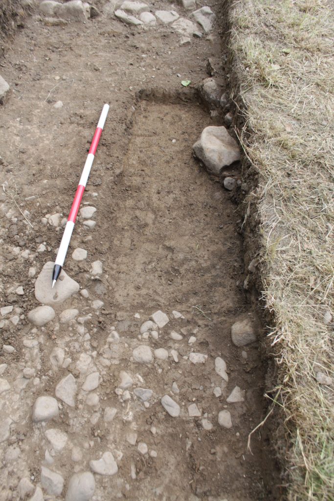
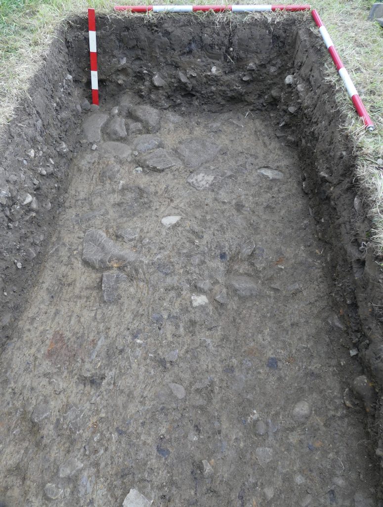
Our first aim was to re-excavate the May 2022 trench and then determine if the ‘hard shoulder’ feature found along the northern edge of the foundation layer abutted or extended below that layer. This feature was a spread of stones in the range of 5cm to 10cm spread out in a band approximately 1.2m wide with an abrupt northern edge. Our second aim was to extend that trench to the south to find the southern edge of the agger. A third aim was to complete plans and section drawings of the work so far. We failed in one respect, as we have not found the southern edge of the road. This was due to the landowner wishing to take a third silage crop and so we were restricted to only a 2m southern extension to our May trench.
Summary
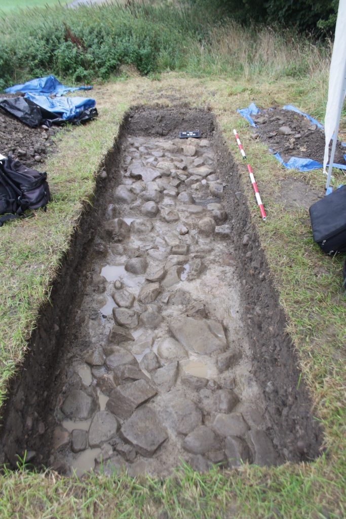
This excavation established that the ‘hard shoulder’ abutted the foundation layer rather than continued underneath it.
In the 2m southern extension we found the same three layer structure found previously. These being a layer of mixed soil, grit, sand and stones generally in the range of 5cm to 15cm the ‘Christmas pudding layer’ (CPL), below this is there is a layer of clean yellow clay which is spread over and between a layer of larger cobbles between 20cm and 30cm which are one cobble thick the foundation layer. This layer sits on more yellow clay which is probably the natural boulder clay or Till.
Thursday 1 September
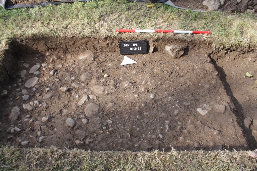
Trench TP3 first excavated in September 2021 and then extended in May 2022, was emptied of the backfill. A small sample of the CPL, which had been left at the S end of the trench, was taken for further examination and then that layer was removed. The trench was then extended by 2m to the South, i.e. further along the probable width of the road and the turf and topsoil removed to reveal the top of the CPL layer.
Friday 2 September
At the North end of the trench the cobbles of the foundation layer were removed for approximately 1 m south of the edge of the ‘hard shoulder’. There was nothing underneath them which showed that the ‘hard shoulder’ did not extend below the foundation layer suggesting it was either contemporary to, or later than the foundation layer. The exact relationship between the CPL layer and the ‘hard shoulder’ is not possible to determine because it was absent above the ‘hard shoulder’ and its junction with the foundation layer.
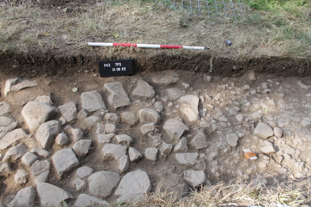
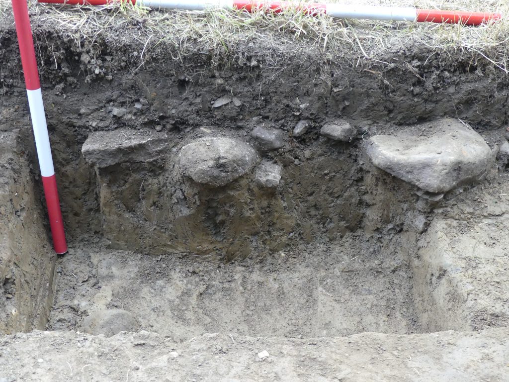
A 0.5m by 1m sondage was dug, on the West side spanning the junction with the foundation layer to a depth of 10cm into stone free yellow clay (natural). This sondarge was extended progressively north through the full extent of the ‘hard shoulder’ and which throughout was revealed to be just one stone deep with stone free clay below (natural).
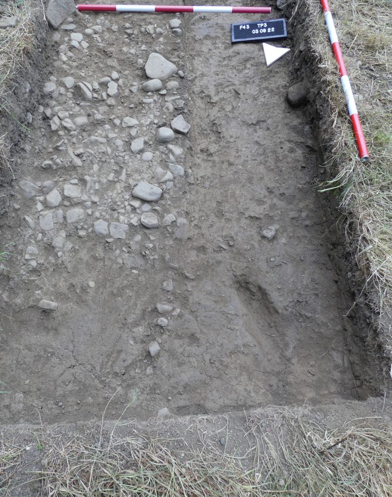
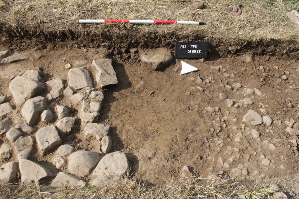
At the southern end of the trench the eastern half of the extension was excavated down to the top of the yellow clay layer above and between the cobbles of the foundation layer.
Saturday 3 September
The northern 1m of the sondage at the junction of the ‘hard shoulder’ with and foundation layer was extended down to a depth of 30cm in to the underlying clay, it was largely stone free except for one 20cm cobble that had a halo that is often seen around stones within the natural Boulder clay suggesting this underlying clay was the “Natural”.
At the South end of the trench the remaining CPL on the western half was excavated down to the top of yellow clay layer above the foundation layer.
Monday 5 September
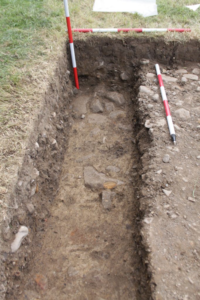
The day was spent revealing the foundation cobbles in the extension and cleaning the whole trench in preparation for drawing and final photography. After recording, the northern 2m of the trench was backfilled.
Thursday 8th September
The morning was spent finishing drawing plans, sections and taking final photographs. Then the trench was backfilled.
Comment
Whilst a significant width of road agger has been uncovered (6m) there is no indication that the edge of the road on the South side has been found and so a further excavation is planned to establish the southern edge. Also we have not established whether the foundation layer is sitting directly on the underlying natural or is situated on a built mound of clay as suggested by other workers. My current best guess is the former. This might be resolved by excavating a machine trench across the road which might reveal in section the subtle outline of a mound or a buried land surface. This also might be the only way that any ditches will be observed, however this is beyond our current resources and I am not convinced it would reveal anything of significance.
Barrie Tyrer March 2023